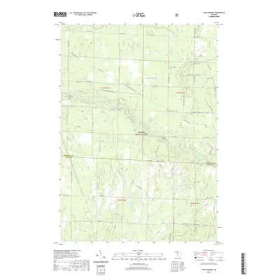
2019 Map of Star Corners
USGS Topo · Published 2019About this map
The Little Manistee River winds through the heart of this Michigan landscape, a waterway central to the geography of the Manistee National Forest. This 2019 survey documents the transition between Manistee and Mason Counties, marked by the line between Co Line Rd and South Co Line Rd. Cultural history is anchored by the Old Stronach Cem in the northwest, while the settlement of Star Corners sits at the junction of several rural routes in the northeast. The map illustrates a complex network of recreational and transit infrastructure, featuring the Marzinski Horse Trail and seasonal snowmobile routes like the Manistee Smt Dnr6 (Snow). Small interior water bodies, including Hoags Lake and Black Lake, punctuate the forested terrain, while the Sixmile Bridge provides a primary crossing over the main river channel.
Find a feature on this map
51 named features on this map. Tap any name to fly to it.
Don’t see what you’re looking for? This feature index may not catch every label — zoom into the map to look around manually.
Map Details
Editions of this 2019 Star Corners Map
This is the sole edition of this map. No revisions or reprints were ever made.
Other maps of this area

1931 · Manistee SE
USGS Topo · 1:31,680

1931 · Freesoil SW
USGS Topo · 1:31,680

1932 · Freesoil SE
USGS Topo · 1:31,680

1954 · Manitowoc
USGS Topo · 1:250,000

1956 · Onekama
USGS Topo · 1:62,500

1956 · Bar Lake
USGS Topo · 1:62,500

1957 · Freesoil
USGS Topo · 1:62,500

1958 · Manitowoc
USGS Topo · 1:250,000

1958 · Manistee
USGS Topo · 1:62,500

1976 · Onekama SE
USGS Topo · 1:24,000