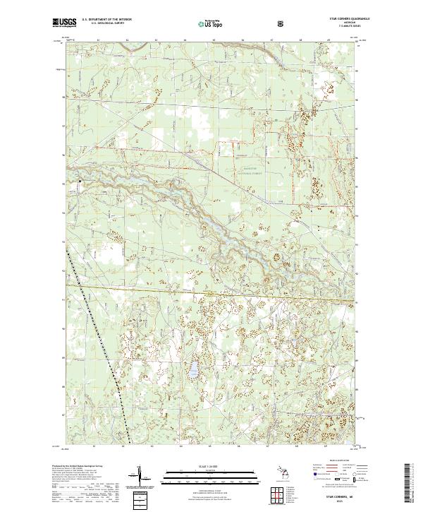
2023 Map of Star Corners
USGS Topo · Published 2023About this map
The Little Manistee River winds through the heart of the Manistee National Forest, carving a path across the northern section of this Michigan landscape. This region, defined by its dense forest cover and intricate network of recreational trails, serves as a significant hub for outdoor activity and land management. Researchers will find the Old Stronach Cem north of the river, providing a point of genealogical interest in an area otherwise dominated by public forest lands and timber management roads. Further south, the terrain transitions into Mason County across the Co Line Rd, where smaller water bodies like Hoags Lake and Black Lake dot the landscape. The road network, including historic routes like Old Stronach Rd and Nine Mile Bridge Rd, reflects the area's history as a center for timber transport and local transit between the scattered rural settlements of the Manistee area.
Find a feature on this map
52 named features on this map. Tap any name to fly to it.
Don’t see what you’re looking for? This feature index may not catch every label — zoom into the map to look around manually.
Map Details
Editions of this 2023 Star Corners Map
This is the sole edition of this map. No revisions or reprints were ever made.
Other maps of this area

1931 · Manistee SE
USGS Topo · 1:31,680

1931 · Freesoil SW
USGS Topo · 1:31,680

1932 · Freesoil SE
USGS Topo · 1:31,680

1954 · Manitowoc
USGS Topo · 1:250,000

1956 · Onekama
USGS Topo · 1:62,500

1956 · Bar Lake
USGS Topo · 1:62,500

1957 · Freesoil
USGS Topo · 1:62,500

1958 · Manitowoc
USGS Topo · 1:250,000

1958 · Manistee
USGS Topo · 1:62,500

1976 · Onekama SE
USGS Topo · 1:24,000