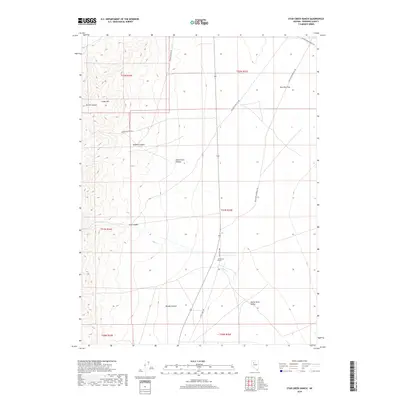
2018 Map of Star Creek Ranch
USGS Topo · Published 2018About this map
Star Creek Ranch sits along the western margins of the Buena Vista Valley, a high desert landscape where the steep drainage of the Humboldt Range meets the valley floor. The geography is defined by a series of prominent canyons that cut through the terrain, including Sacred Canyon, Tehama Canyon, and the strikingly named Bloody Canyon. These features illustrate the local hydrology, where seasonal flows from Star Cr and other mountain runs provide vital water for ranching operations in an otherwise arid basin. Transportation throughout this portion of Pershing County relies on a network of unpaved roads such as Dun Glen-Star City Rd and Dun Glen-Unionville Rd, which trace the historical routes between mining districts and homesteads. North of the ranch, Dun Glen Flat marks a broad expanse near Creek Hill, showing the transition from the rugged peaks of t31n r34e to the flatter plains of t32n r35e.
Find a feature on this map
21 named features on this map. Tap any name to fly to it.
Don’t see what you’re looking for? This feature index may not catch every label — zoom into the map to look around manually.
Map Details
Editions of this 2018 Star Creek Ranch Map
This is the sole edition of this map. No revisions or reprints were ever made.
Other maps of this area

1931 · Lovelock
USGS Topo · 1:250,000

1932 · Sonoma Range
USGS Topo · 1:250,000

1935 · Lovelock
USGS Topo · 1:250,000

1939 · Sonoma Range
USGS Topo · 1:250,000

1954 · Unionville
USGS Topo · 1:62,500

1955 · Lovelock
USGS Topo · 1:250,000

1955 · Winnemucca
USGS Topo · 1:250,000

1956 · Imlay
USGS Topo · 1:62,500

1958 · Winnemucca
USGS Topo · 1:250,000

1959 · Lovelock
USGS Topo · 1:250,000