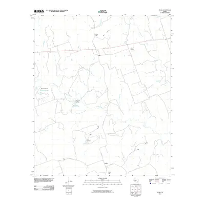
2010 Map of Star
USGS Topo · Published 2010About this map
Star and Moline anchor this Lampasas County landscape, characterized by the rugged passage of ranch roads through numerous gaps in the limestone terrain. The Lampasas River cuts across the northeastern corner, while Bennett Creek and its tributaries, including Slaughter Branch and Long Branch, define the local drainage. Water management is a visible priority for local residents, evidenced by multiple dammed structures including Head Lake Dam, Norwood Lake Dam, and the McCasland Irrigation Lake Dam. These small reservoirs sit tucked into the folds of the hills near prominent topographic markers like Star Mountain and Hurst Gap. Genealogists may find interest in the Hurst Ranch Cemetery located just off Co Rd 534, providing a specific point of family history within the larger ranching tradition of the area. The network of county roads and ranch routes like Ranch Rd 1047 shows how modern infrastructure continues to follow the natural contours of gaps such as Payne Gap and Castle Gap.
Find a feature on this map
39 named features on this map. Tap any name to fly to it.
Don’t see what you’re looking for? This feature index may not catch every label — zoom into the map to look around manually.
Map Details
Editions of this 2010 Star Map
This is the sole edition of this map. No revisions or reprints were ever made.
Other maps of this area

1887 · Lampasas
USGS Topo · 1:125,000

1888 · Hamilton
USGS Topo · 1:125,000

1894 · Hamilton
USGS Topo · 1:125,000

1894 · Lampasas
USGS Topo · 1:125,000

1954 · Brownwood
USGS Topo · 1:250,000

1954 · Evant
USGS Topo · 1:62,500

1954 · Evant
USGS Topo · 1:24,000
1954 · Adamsville
USGS Topo · 1:24,000

1956 · Pottsville
USGS Topo · 1:62,500

1956 · Hamilton
USGS Topo · 1:62,500