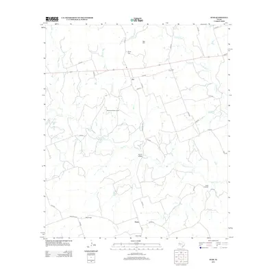
2012 Map of Star
USGS Topo · Published 2012About this map
Star and Moline anchor this Central Texas landscape where the high ground of the Edwards Plateau meets the drainage basins of the Lampasas River. The terrain is defined by significant gaps and hollows, including Hurst Gap, Pigfoot Hollow, and Castle Gap, which have historically influenced the passage of travelers and the placement of cattle ranching operations. Along the river and its tributaries like Slaughter Br and Bennett Cr, the presence of McCasland Irrigation Lake and Norwood Lake points to the essential nature of water management in this region. Private aviation and ranching legacies are evident at the McCasland Ranch Airport and the Hurst Ranch Cem. The local road network, including Us HWY 84 and Ranch Road 572, traces the natural contours of the land, connecting these remote ranching communities and family holdings.
Find a feature on this map
43 named features on this map. Tap any name to fly to it.
Don’t see what you’re looking for? This feature index may not catch every label — zoom into the map to look around manually.
Map Details
Editions of this 2012 Star Map
This is the sole edition of this map. No revisions or reprints were ever made.
Other maps of this area

1887 · Lampasas
USGS Topo · 1:125,000

1888 · Hamilton
USGS Topo · 1:125,000

1894 · Hamilton
USGS Topo · 1:125,000

1894 · Lampasas
USGS Topo · 1:125,000

1954 · Brownwood
USGS Topo · 1:250,000

1954 · Evant
USGS Topo · 1:62,500

1954 · Evant
USGS Topo · 1:24,000
1954 · Adamsville
USGS Topo · 1:24,000

1956 · Pottsville
USGS Topo · 1:62,500

1956 · Hamilton
USGS Topo · 1:62,500