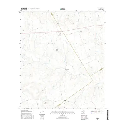
2016 Map of Star
USGS Topo · Published 2016About this map
Star and Moline anchor this Central Texas landscape where the boundaries of Hamilton, Mills, and Lampasas counties converge. The terrain is defined by dramatic limestone features and gaps, most notably Star Mtn, Hurst Gap, and Castle Gap, which have long dictated the movement of people and cattle through this region. The Lampasas River flows through the eastern portion of the map, while numerous seasonal drainages like Slaughter Br and Bennett Cr carve out canyons and hollows such as Pigfoot Hollow.
Find a feature on this map
46 named features on this map. Tap any name to fly to it.
Don’t see what you’re looking for? This feature index may not catch every label — zoom into the map to look around manually.
Map Details
Editions of this 2016 Star Map
This is the sole edition of this map. No revisions or reprints were ever made.
Other maps of this area

1887 · Lampasas
USGS Topo · 1:125,000

1888 · Hamilton
USGS Topo · 1:125,000

1894 · Hamilton
USGS Topo · 1:125,000

1894 · Lampasas
USGS Topo · 1:125,000

1954 · Brownwood
USGS Topo · 1:250,000

1954 · Evant
USGS Topo · 1:62,500

1954 · Evant
USGS Topo · 1:24,000
1954 · Adamsville
USGS Topo · 1:24,000

1956 · Pottsville
USGS Topo · 1:62,500

1956 · Hamilton
USGS Topo · 1:62,500