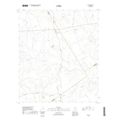
2019 Map of Star
USGS Topo · Published 2019About this map
Moline serves as the central settlement point in this region where Hamilton, Mills, and Lampasas counties converge. The landscape is defined by its dramatic relief, featuring prominent elevations such as Star Mtn and Payne Mtn, punctuated by natural passes like Hurst Gap, Payne Gap, and Castle Gap. These gaps historically facilitated movement through the varied terrain of central Texas.
Find a feature on this map
44 named features on this map. Tap any name to fly to it.
Don’t see what you’re looking for? This feature index may not catch every label — zoom into the map to look around manually.
Map Details
Editions of this 2019 Star Map
This is the sole edition of this map. No revisions or reprints were ever made.
Other maps of this area

1887 · Lampasas
USGS Topo · 1:125,000

1888 · Hamilton
USGS Topo · 1:125,000

1894 · Hamilton
USGS Topo · 1:125,000

1894 · Lampasas
USGS Topo · 1:125,000

1954 · Brownwood
USGS Topo · 1:250,000

1954 · Evant
USGS Topo · 1:62,500

1954 · Evant
USGS Topo · 1:24,000
1954 · Adamsville
USGS Topo · 1:24,000

1956 · Pottsville
USGS Topo · 1:62,500

1956 · Hamilton
USGS Topo · 1:62,500