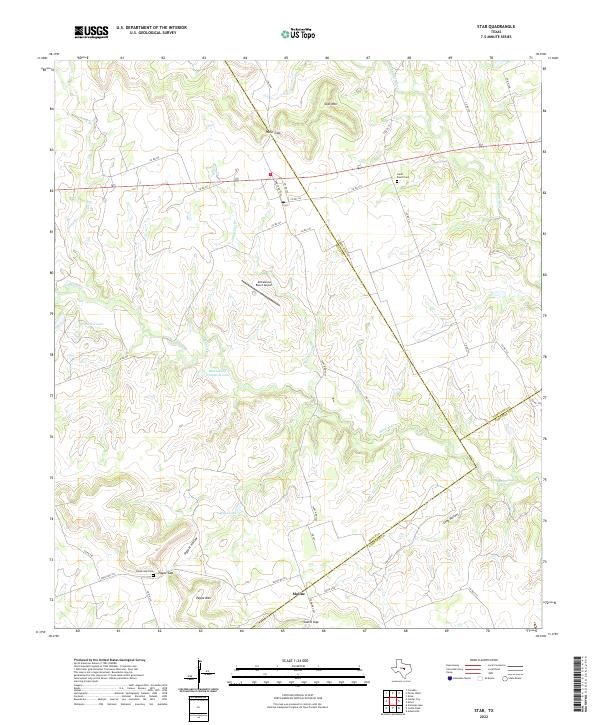
2022 Map of Star
USGS Topo · Published 2022About this map
The Hamilton and Mills County line cuts through this section of the Texas Hill Country, where the landscape is defined by its deep gaps and limestone summits. Small settlements such as Moline and Payne Gap are connected by a network of ranch roads that navigate the complex topography of the Lampasas River drainage. In the northern reaches, Star Mtn rises above Hurst Gap, providing a vantage over a region where agriculture and aviation meet at the McCasland Ranch Airport. Local history is anchored by family-named sites like Hurst Ranch Cem and the Payne Gap Cem located near the foot of Payne Mtn. Significant water management is evident through features like McCasland Irrigation Lake and Head Lake, which support the rural economy along the banks of Slaughter Br and Bennett Cr.
Find a feature on this map
45 named features on this map. Tap any name to fly to it.
Don’t see what you’re looking for? This feature index may not catch every label — zoom into the map to look around manually.
Map Details
Editions of this 2022 Star Map
This is the sole edition of this map. No revisions or reprints were ever made.
Other maps of this area

1887 · Lampasas
USGS Topo · 1:125,000

1888 · Hamilton
USGS Topo · 1:125,000

1894 · Hamilton
USGS Topo · 1:125,000

1894 · Lampasas
USGS Topo · 1:125,000

1954 · Brownwood
USGS Topo · 1:250,000

1954 · Evant
USGS Topo · 1:62,500

1954 · Evant
USGS Topo · 1:24,000
1954 · Adamsville
USGS Topo · 1:24,000

1956 · Pottsville
USGS Topo · 1:62,500

1956 · Hamilton
USGS Topo · 1:62,500