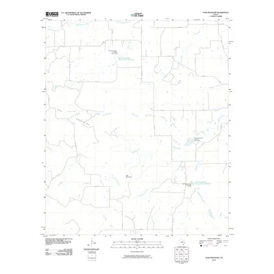
2010 Map of Star Mountain
USGS Topo · Published 2010About this map
The Hog Mountains rise across the western portion of this Central Texas landscape, defining a terrain shaped by numerous seasonal drainage systems. The namesake Star Mountain stands as a primary landmark in the southern interior, situated near the headwaters of Little Jimmys Creek. This 2010 survey highlights a sophisticated network of local water management, featuring several flood control structures such as the Soil Conservation Service Site 10 Dam and the Soil Conservation Service Site 7 Reservoir. These engineering works, managed by the Soil Conservation Service, are integrated into a rural landscape of ranch roads and county routes like FM 1689 and Co RD 175. The drainage patterns are complex, with waters flowing through systems including Patridge Creek, Rabbit Creek, and South Copperas Creek, illustrating the vital importance of watershed management in this part of Brown County.
Find a feature on this map
33 named features on this map. Tap any name to fly to it.
Don’t see what you’re looking for? This feature index may not catch every label — zoom into the map to look around manually.
Map Details
Editions of this 2010 Star Mountain Map
This is the sole edition of this map. No revisions or reprints were ever made.
Other maps of this area

1889 · Brownwood
USGS Topo · 1:125,000

1894 · Eastland
USGS Topo · 1:125,000

1894 · Brownwood
USGS Topo · 1:125,000

1954 · Brownwood
USGS Topo · 1:250,000

1954 · Abilene
USGS Topo · 1:250,000

1958 · Abilene
USGS Topo · 1:250,000
1966 · Owens
USGS Topo · 1:24,000
1966 · May
USGS Topo · 1:24,000

1966 · Star Mountain
USGS Topo · 1:24,000

1966 · Sipe Springs
USGS Topo · 1:24,000