
1966 Map of Sipe Springs
USGS Topo · Published 1968About this map
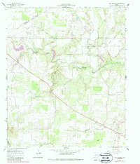
Sipe Springs sits at a geographic crossroads in the Texas hill country, defined by the winding course of Copperas Creek and its many tributaries like Newton Branch and Keys Branch. By the mid-1960s, the landscape reflected a transition from early rail-dependent commerce to a modern energy and extraction economy. The path of an Old Railroad Grade cuts across the northern terrain, serving as a reminder of former transport corridors, while numerous Oil Wells, a Quarry, and various Gravel Pits indicate the active industrial pulse of the era. Genealogists and local historians can locate specific family landmarks such as the Parker Cem and Sipe Springs Cem, alongside the small settlement of Stag Creek in the southeast corner. The presence of a Landing Strip near the confluence of South Copperas Creek further underscores the evolving connectivity of this rural Comanche County district.
Find a feature on this map
21 named features on this map. Tap any name to fly to it.
Don’t see what you’re looking for? This feature index may not catch every label — zoom into the map to look around manually.
Map Details
Editions of this 1966 Sipe Springs Map
2 editions found
Other maps of this area

1889 · Brownwood
USGS Topo · 1:125,000

1894 · Eastland
USGS Topo · 1:125,000

1894 · Brownwood
USGS Topo · 1:125,000

1954 · Brownwood
USGS Topo · 1:250,000

1954 · Abilene
USGS Topo · 1:250,000

1958 · Abilene
USGS Topo · 1:250,000
1966 · May
USGS Topo · 1:24,000

1966 · Star Mountain
USGS Topo · 1:24,000
1966 · Rising Star
USGS Topo · 1:24,000
1968 · Gorman
USGS Topo · 1:24,000