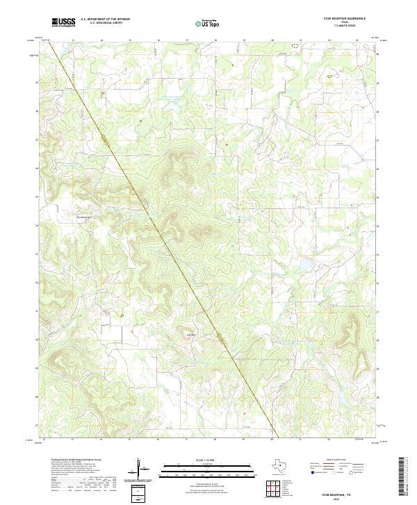
2022 Map of Star Mountain
USGS Topo · Published 2022About this map
The Comanche Co and Brown Co line cuts diagonally through this landscape, dividing a terrain defined by the Hog Mountains and the prominent height of Star Mtn. The hydrology of the region is shaped by numerous ephemeral and perennial watercourses, including the westward-flowing Gap Cr and the network of Jimmys Cr and Little Jimmys Cr. Modern water management is evident in the presence of the Soil Conservation Service Site 11 Reservoir and Soil Conservation Service Site 7 Reservoir, which serve as critical infrastructure in this rural Texas environment.
Find a feature on this map
34 named features on this map. Tap any name to fly to it.
Don’t see what you’re looking for? This feature index may not catch every label — zoom into the map to look around manually.
Map Details
Editions of this 2022 Star Mountain Map
This is the sole edition of this map. No revisions or reprints were ever made.
Other maps of this area

1889 · Brownwood
USGS Topo · 1:125,000

1894 · Eastland
USGS Topo · 1:125,000

1894 · Brownwood
USGS Topo · 1:125,000

1954 · Brownwood
USGS Topo · 1:250,000

1954 · Abilene
USGS Topo · 1:250,000

1958 · Abilene
USGS Topo · 1:250,000
1966 · Owens
USGS Topo · 1:24,000
1966 · May
USGS Topo · 1:24,000

1966 · Star Mountain
USGS Topo · 1:24,000

1966 · Sipe Springs
USGS Topo · 1:24,000