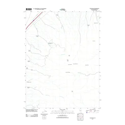
2011 Map of Star Peak
USGS Topo · Published 2011About this map
Humboldt City sits along the western slopes of the Humboldt Range, marking a site of early settlement in the Great Basin. This high-altitude desert landscape is defined by its deep drainages, including Florida Canyon and Black Canyon, which cut through the western face of the mountains toward the interstate corridor. High peaks dominate the eastern half of the map, notably Star Peak and Thunder Mountain, while numerous family-named landmarks like Indian Ikes Point and Van Zant Peak suggest the ranching and prospecting history of Pershing County. Drainage systems such as Humboldt Creek and Antelope Creek flow from the high ridges, providing vital water sources in this arid environment. The map captures the intersection of modern transportation via Interstate 80 with the older, more isolated topography of the northern Nevada interior.
Find a feature on this map
25 named features on this map. Tap any name to fly to it.
Don’t see what you’re looking for? This feature index may not catch every label — zoom into the map to look around manually.
Map Details
Editions of this 2011 Star Peak Map
This is the sole edition of this map. No revisions or reprints were ever made.
Other maps of this area

1931 · Lovelock
USGS Topo · 1:250,000

1935 · Lovelock
USGS Topo · 1:250,000

1954 · Unionville
USGS Topo · 1:62,500

1955 · Lovelock
USGS Topo · 1:250,000

1956 · Oreana
USGS Topo · 1:62,500

1956 · Imlay
USGS Topo · 1:62,500

1959 · Lovelock
USGS Topo · 1:250,000

1971 · Rye Patch Reservoir South
USGS Topo · 1:24,000

1971 · Rye Patch Reservoir North
USGS Topo · 1:24,000

1984 · Lovelock
USGS Topo · 1:100,000