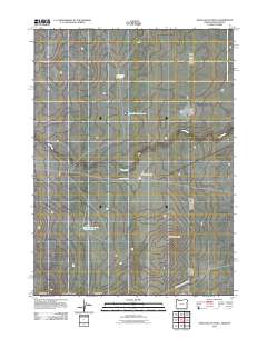
2011 Map of Star Valley Knoll
USGS Topo · Published 2011About this map
Star Valley Knoll rises as a prominent landmark in this high-desert landscape near the meeting of Oregon, Idaho, and Nevada. The area is defined by a series of isolated water management features essential for life in the arid Great Basin, including Rabbit Run Reservoir and East Side Reservoir in the north, and South Willow Creek Butte Reservoir to the south. These artificial pools capture seasonal runoff to support local needs in a region where naturally occurring water is scarce, as seen with the small Pigeon-toe Lake and the intermittent drainage of Tent Creek. Practical access through this open terrain is provided by unpaved tracks like Tent Creek Rd, while the State and County Line Rd traces the jurisdictional boundaries that converge in this remote corner of Malheur County.
Find a feature on this map
8 named features on this map. Tap any name to fly to it.
Don’t see what you’re looking for? This feature index may not catch every label — zoom into the map to look around manually.
Map Details
Editions of this 2011 Star Valley Knoll Map
This is the sole edition of this map. No revisions or reprints were ever made.
Other maps of this area

1882 · Paradise
USGS Topo · 1:250,000

1893 · Paradise
USGS Topo · 1:250,000

1955 · McDermitt
USGS Topo · 1:250,000

1955 · Jordan Valley
USGS Topo · 1:250,000

1957 · Jordan Valley
USGS Topo · 1:250,000

1958 · Jordan Valley
USGS Topo · 1:250,000

1959 · McDermitt
USGS Topo · 1:250,000

1973 · Spring Creek Basin
USGS Topo · 1:24,000
1973 · Star Valley
USGS Topo · 1:24,000
1973 · Star Valley Ridge West
USGS Topo · 1:24,000