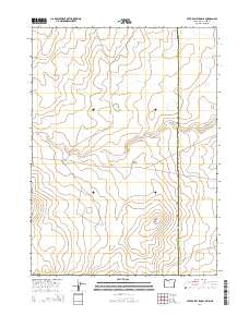
2014 Map of Star Valley Knoll
USGS Topo · Published 2014About this map
Star Valley Knoll stands as a prominent topographical landmark in this high-desert region where the boundaries of Oregon, Idaho, and Nevada converge. This 2014 survey documents a remote landscape defined by the drainage of Tent Cr, which meanders across the Malheur County terrain. The presence of Pigeon-toe Lake provides a rare water source in this arid environment, while the grid of public land surveys—including t40s r48e and t41s r48e—partitions the open range. A single primary thoroughfare, State and Co Line Rd, traces the jurisdictional divide between Malheur and Owyhee counties. This map is a record of the modern geography of the high plateau, illustrating the sparse infrastructure and natural water features essential for regional land management.
Find a feature on this map
13 named features on this map. Tap any name to fly to it.
Don’t see what you’re looking for? This feature index may not catch every label — zoom into the map to look around manually.
Map Details
Editions of this 2014 Star Valley Knoll Map
This is the sole edition of this map. No revisions or reprints were ever made.
Other maps of this area

1882 · Paradise
USGS Topo · 1:250,000

1893 · Paradise
USGS Topo · 1:250,000

1955 · McDermitt
USGS Topo · 1:250,000

1955 · Jordan Valley
USGS Topo · 1:250,000

1957 · Jordan Valley
USGS Topo · 1:250,000

1958 · Jordan Valley
USGS Topo · 1:250,000

1959 · McDermitt
USGS Topo · 1:250,000

1973 · Spring Creek Basin
USGS Topo · 1:24,000
1973 · Star Valley
USGS Topo · 1:24,000
1973 · Star Valley Ridge West
USGS Topo · 1:24,000