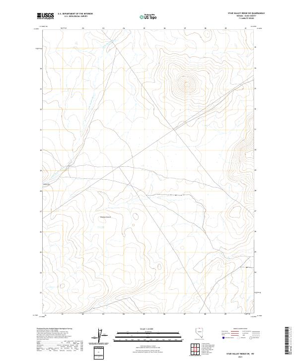
2021 Map of Star Valley Ridge SW
USGS Topo · Published 2021About this map
Owyhee Desert terrain dominates this high-plateau landscape in Elko County, where the north-flowing Little Owyhee River carves a winding path through the arid flats. The map reflects a modern inventory of the region, emphasizing the drainage patterns and the few permanent water features like Lake Cr in the southeastern corner. A notable human landmark appears as Dobe Doc near the western edge, positioned along a sparse network of roads that crisscross the sagebrush country. This survey illustrates the vast, open character of Nevada’s northern borderlands, where the landscape is defined more by its hydrography and public land survey system lines—such as t46n r45e and t45n r45e—than by concentrated settlement. It provides a technical record of the land surface just before the 2020s, showing the intersection of intermittent stream beds and the isolated outposts of the high desert.
Find a feature on this map
9 named features on this map. Tap any name to fly to it.
Don’t see what you’re looking for? This feature index may not catch every label — zoom into the map to look around manually.
Map Details
Editions of this 2021 Star Valley Ridge SW Map
This is the sole edition of this map. No revisions or reprints were ever made.
Other maps of this area

1882 · Paradise
USGS Topo · 1:250,000

1893 · Paradise
USGS Topo · 1:250,000

1955 · McDermitt
USGS Topo · 1:250,000

1959 · McDermitt
USGS Topo · 1:250,000

1973 · Star Valley Ridge SW
USGS Topo · 1:24,000

1973 · Button Lake Well
USGS Topo · 1:24,000
1973 · Star Valley Ridge East
USGS Topo · 1:24,000

1973 · Corral Lake
USGS Topo · 1:24,000
1973 · Star Valley Ridge West
USGS Topo · 1:24,000
1973 · Star Valley Ridge SE
USGS Topo · 1:24,000