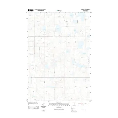
2013 Map of Starbuck NW
USGS Topo · Published 2013About this map
Glacial topography and a dense network of water bodies define this portion of Pope County, where the Chippewa River and the Little Chippewa River wind through a landscape dominated by family-named lakes. The distribution of Pike Lake Cem, Nora Cem, and Saint John's Cem across the township grid suggests the historical locations of rural congregations and early settlements in this agricultural region. The map reveals how local transit follows the Section Lines, with routes like Co HWY-32 and Co HWY-24 connecting the scattered farmsteads. Numerous basins such as Abrahamson Lake, Christopherson Lake, and Lybeck Lake fill the depressions between the low hills, illustrating the typical kettle-and-kame geography of the Minnesota prairie-lake region. This 2013 survey provides a clear look at the persistent rural character of the area, where name-bearing landmarks like Anderson Lake and Erickson Lake tie the modern landscape to its pioneer-era genealogy.
Find a feature on this map
38 named features on this map. Tap any name to fly to it.
Don’t see what you’re looking for? This feature index may not catch every label — zoom into the map to look around manually.
Map Details
Editions of this 2013 Starbuck NW Map
This is the sole edition of this map. No revisions or reprints were ever made.
Other maps of this area

1911 · Barrett
USGS Topo · 1:62,500

1912 · Morris
USGS Topo · 1:62,500

1953 · Saint Cloud
USGS Topo · 1:250,000

1957 · Saint Cloud
USGS Topo · 1:250,000

1958 · Saint Cloud
USGS Topo · 1:250,000

1966 · Farwell
USGS Topo · 1:24,000

1966 · Kensington
USGS Topo · 1:24,000

1968 · Cyrus
USGS Topo · 1:24,000

1968 · Starbuck
USGS Topo · 1:24,000

1968 · Lowry
USGS Topo · 1:24,000