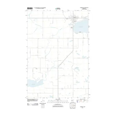
2010 Map of Starbuck
USGS Topo · Published 2010About this map
Lake Minnewaska dominates the northeastern landscape of this region, with the city of Starbuck situated along its western shore. This 2010 survey reveals a community deeply connected to its water resources, from the recreational grounds of Hobo Park Campground to the drainage networks of County Ditch Number Two and Outlet Creek. The terrain is characterized by agricultural grids and natural waterways, including the Little Chippewa River and the southern waters of Lake Emily. Genealogists will find several burial sites preserved here, such as Minnewaska Cemetery and the rural Bethany Cemetery. The presence of the Starbuck Municipal Airport and the Starbuck Post Office marks the town's role as a local service hub for Pope County during the early 21st century.
Find a feature on this map
47 named features on this map. Tap any name to fly to it.
Don’t see what you’re looking for? This feature index may not catch every label — zoom into the map to look around manually.
Map Details
Editions of this 2010 Starbuck Map
This is the sole edition of this map. No revisions or reprints were ever made.
Other maps of this area

1953 · Saint Cloud
USGS Topo · 1:250,000

1957 · Saint Cloud
USGS Topo · 1:250,000

1958 · Saint Cloud
USGS Topo · 1:250,000

1968 · Cyrus
USGS Topo · 1:24,000

1968 · Starbuck
USGS Topo · 1:24,000

1968 · Lowry
USGS Topo · 1:24,000

1968 · Glenwood
USGS Topo · 1:24,000

1968 · Lake Hassel
USGS Topo · 1:24,000

1968 · Starbuck NW
USGS Topo · 1:24,000
1968 · Lake Minnewaska
USGS Topo · 1:24,000