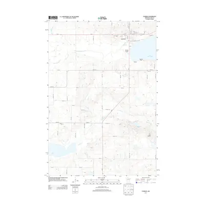
2013 Map of Starbuck
USGS Topo · Published 2013About this map
Starbuck serves as the focal point for this section of Pope County, situated on the western shore of the expansive Lake Minnewaska. The landscape is defined by its glacial hydrology, where Outlet Cr and Signalness Cr drain toward several significant water bodies, including Signalness Lake and Lake Emily. The terrain is punctuated by the Blue Mounds to the south and Barsness Point along the lakefront, reflecting the varied topography of western Minnesota. Local genealogy is well-supported by the presence of several community burial grounds, including Minnewaska Cem, Bethany Cem, and Fron Cem, which mark the settlement history of the surrounding townships. Transportation is anchored by the junction of MN-28 and MN-29, providing access to the Starbuck Municipal Airport and the recreational facilities at Hobo Park Campground along the shoreline.
Find a feature on this map
55 named features on this map. Tap any name to fly to it.
Don’t see what you’re looking for? This feature index may not catch every label — zoom into the map to look around manually.
Map Details
Editions of this 2013 Starbuck Map
This is the sole edition of this map. No revisions or reprints were ever made.
Other maps of this area

1953 · Saint Cloud
USGS Topo · 1:250,000

1957 · Saint Cloud
USGS Topo · 1:250,000

1958 · Saint Cloud
USGS Topo · 1:250,000

1968 · Cyrus
USGS Topo · 1:24,000

1968 · Starbuck
USGS Topo · 1:24,000

1968 · Lowry
USGS Topo · 1:24,000

1968 · Glenwood
USGS Topo · 1:24,000

1968 · Lake Hassel
USGS Topo · 1:24,000

1968 · Starbuck NW
USGS Topo · 1:24,000
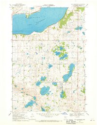
1968 · Lake Minnewaska
USGS Topo · 1:24,000