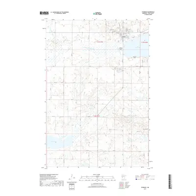
2019 Map of Starbuck
USGS Topo · Published 2019About this map
Starbuck anchors the northern landscape of this Pope County quadrangle, situated on the southwestern shores of Lake Minnewaska. The town's grid is dense with residential and commercial streets, including an Industrial Park to the northwest and the Starbuck Municipal Airport to the south. Three local burial grounds—Minnewaska Cem, Fron Cem, and Bethany Cem—provide significant points of interest for genealogists tracing family roots in this prairie and lake region.
Find a feature on this map
73 named features on this map. Tap any name to fly to it.
Don’t see what you’re looking for? This feature index may not catch every label — zoom into the map to look around manually.
Map Details
Editions of this 2019 Starbuck Map
This is the sole edition of this map. No revisions or reprints were ever made.
Other maps of this area

1953 · Saint Cloud
USGS Topo · 1:250,000

1957 · Saint Cloud
USGS Topo · 1:250,000

1958 · Saint Cloud
USGS Topo · 1:250,000

1968 · Cyrus
USGS Topo · 1:24,000

1968 · Starbuck
USGS Topo · 1:24,000

1968 · Lowry
USGS Topo · 1:24,000

1968 · Glenwood
USGS Topo · 1:24,000

1968 · Lake Hassel
USGS Topo · 1:24,000

1968 · Starbuck NW
USGS Topo · 1:24,000
1968 · Lake Minnewaska
USGS Topo · 1:24,000