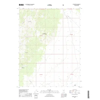
2018 Map of Stargo Creek
USGS Topo · Published 2018About this map
The Monitor Range and Red Mountains dominate this high-desert landscape in central Nevada, where the drainage of Stargo Creek and Savory Creek flows toward the eastern basins. Set within the Toiyabe National Forest, the map reveals a terrain defined by sharp elevation shifts and seasonal water sources like Stargo Spring. The presence of the Miniature Grand Canyon suggests a particularly dramatic erosion pattern carved into the volcanic or sedimentary rock of the region.
Find a feature on this map
21 named features on this map. Tap any name to fly to it.
Don’t see what you’re looking for? This feature index may not catch every label — zoom into the map to look around manually.
Map Details
Editions of this 2018 Stargo Creek Map
This is the sole edition of this map. No revisions or reprints were ever made.
Other maps of this area

1926 · Roberts Mountains
USGS Topo · 1:250,000

1929 · Roberts Mountains
USGS Topo · 1:250,000

1955 · Millett
USGS Topo · 1:250,000

1956 · Horse Heaven Mtn
USGS Topo · 1:62,500

1956 · Tonopah
USGS Topo · 1:250,000

1959 · Tonopah
USGS Topo · 1:250,000

1959 · Millett
USGS Topo · 1:250,000

1960 · Dianas Punch Bowl
USGS Topo · 1:62,500

1962 · Tonopah
USGS Topo · 1:250,000

1968 · Fish Springs
USGS Topo · 1:62,500