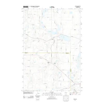
2013 Map of Stark
USGS Topo · Published 2013About this map
Stark and Harris anchor this 2013 study of the glacial lake country along the border of Chisago and Isanti Counties. The landscape is defined by a dense network of water bodies, from the larger Fish Lake and Spring Lake to the meandering Goose Creek and the N Br Sunrise River. Human activity is intertwined with these waters, as seen in the extensive engineering of Judicial Ditch Number Four, which manages drainage through the lowlands.
Find a feature on this map
69 named features on this map. Tap any name to fly to it.
Don’t see what you’re looking for? This feature index may not catch every label — zoom into the map to look around manually.
Map Details
Editions of this 2013 Stark Map
This is the sole edition of this map. No revisions or reprints were ever made.
Other maps of this area

1950 · Rush City
USGS Topo · 1:48,000

1953 · Stillwater
USGS Topo · 1:250,000

1955 · Rush City
USGS Topo · 1:62,500

1955 · Forest Lake
USGS Topo · 1:62,500

1955 · Isanti
USGS Topo · 1:62,500

1955 · Stillwater
USGS Topo · 1:250,000

1958 · Stillwater
USGS Topo · 1:250,000

1961 · Cambridge
USGS Topo · 1:62,500

1965 · Stillwater
USGS Topo · 1:250,000
1974 · Stacy
USGS Topo · 1:24,000