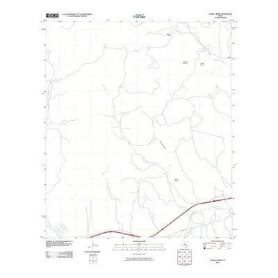
2010 Map of Stark Creek
USGS Topo · Published 2010About this map
The small settlement of Cleo sits at the northeastern edge of this Hill Country landscape, positioned near the confluence of Bear Creek and West Bear Creek. The terrain is defined by a dense network of seasonal drainages and named canyons that carve through the limestone plateau, including Walnut Canyon, Turkey Hollow, and Bee Cave Hollow. These features emphasize the area's complex hydrology, where water travels through systems like Stark Creek and North Creek before reaching the larger drainage basin to the south.
Find a feature on this map
14 named features on this map. Tap any name to fly to it.
Don’t see what you’re looking for? This feature index may not catch every label — zoom into the map to look around manually.
Map Details
Editions of this 2010 Stark Creek Map
This is the sole edition of this map. No revisions or reprints were ever made.
Other maps of this area

1893 · Rock Springs
USGS Topo · 1:125,000

1893 · Fort McKavett
USGS Topo · 1:125,000

1932 · Junction
USGS Topo · 1:62,500

1954 · Llano
USGS Topo · 1:250,000

1954 · Sonora
USGS Topo · 1:250,000

1955 · Llano
USGS Topo · 1:250,000

1956 · Llano
USGS Topo · 1:250,000

1958 · Sonora
USGS Topo · 1:250,000

1962 · Roosevelt
USGS Topo · 1:24,000

1963 · McKegan Draw
USGS Topo · 1:24,000