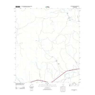
2012 Map of Stark Creek
USGS Topo · Published 2012About this map
Cleo stands as the primary settlement in this corner of the Hill Country, situated where the landscape transitions into the limestone breaks and canyons typical of Kimble County. The southern portion of the area is defined by the N Llano River, a vital water source that draws together several significant drainages, including Calf Cr and North Cr. This 2012 snapshot of the region captures a landscape of managed ranch lands, evidenced by family-named landmarks like Kennedy Ranch Rd and the intricate network of county roads. The terrain is deeply carved by intermittent watercourses such as Stark Cr and Bear Cr, while distinctive topography is named at Bee Cave Hollow, Walnut Canyon, and Gilliam Draw. The presence of Ranch Road 1674 and Frontage Rd along the southern corridor reflects the modern infrastructure supporting this rural community.
Find a feature on this map
25 named features on this map. Tap any name to fly to it.
Don’t see what you’re looking for? This feature index may not catch every label — zoom into the map to look around manually.
Map Details
Editions of this 2012 Stark Creek Map
This is the sole edition of this map. No revisions or reprints were ever made.
Other maps of this area

1893 · Rock Springs
USGS Topo · 1:125,000

1893 · Fort McKavett
USGS Topo · 1:125,000

1932 · Junction
USGS Topo · 1:62,500

1954 · Llano
USGS Topo · 1:250,000

1954 · Sonora
USGS Topo · 1:250,000

1955 · Llano
USGS Topo · 1:250,000

1956 · Llano
USGS Topo · 1:250,000

1958 · Sonora
USGS Topo · 1:250,000

1962 · Roosevelt
USGS Topo · 1:24,000

1963 · McKegan Draw
USGS Topo · 1:24,000