
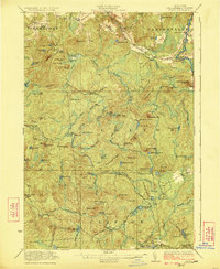
1923 Map of Stark
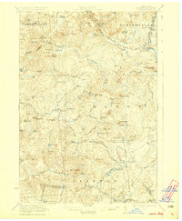
USGS Topo · Published 1944About this map
Stark Falls and the surrounding timber and sporting lands of St. Lawrence County are captured here in the early 1920s. This landscape is defined by the three branches of the Grass River—the South Branch, Middle Branch, and the Conkey Branch—which supported early industry like Gleasons Mill. The map reveals a network of remote encampments and private sporting clubs, including the Stillwater Club, Hollywood Club, and Massawepie Club, reflecting the era's transition toward recreational forest use. Local education and small-scale settlement are preserved through landmarks such as Littlejohn School, Sellecks Cors, and Medbury. Higher elevations like Catamount Mtn and Tooley Pond Mtn are noted with their respective fire stations, signaling the importance of forest protection in this river-veined interior.
Find a feature on this map
96 named features on this map. Tap any name to fly to it.
Don’t see what you’re looking for? This feature index may not catch every label — zoom into the map to look around manually.
Map Details
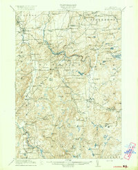
Editions of this 1923 Stark Map
4 editions found

Other maps of this area

1907 · Tupper Lake
USGS Topo · 1:62,500

1908 · Potsdam
USGS Topo · 1:62,500

1910 · Canton
USGS Topo · 1:62,500

1911 · Canton
USGS Topo · 1:62,500

1915 · Russell
USGS Topo · 1:62,500

1916 · Oswegatchie
USGS Topo · 1:62,500
1918 · Russell
USGS Topo · 1:62,500

1918 · Oswegatchie
USGS Topo · 1:62,500

1919 · Nicholville
USGS Topo · 1:62,500

1919 · Cranberry Lake
USGS Topo · 1:62,500