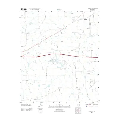
2012 Map of Starrville
USGS Topo · Published 2012About this map
Starrville and the surrounding Smith County countryside appear as a patchwork of rural homesteads and agricultural land during the early 21st century. The landscape is defined by its small community centers like Friendship and Browning, and the presence of numerous family and church burial grounds, including Old Hopewell Cem, Pinkston Cem, and Gabriel Cem. These cemeteries, scattered among the drainages of Rice Cr and Prairie Cr, provide significant data points for genealogists tracing local families in this part of East Texas.
Find a feature on this map
82 named features on this map. Tap any name to fly to it.
Don’t see what you’re looking for? This feature index may not catch every label — zoom into the map to look around manually.
Map Details
Editions of this 2012 Starrville Map
This is the sole edition of this map. No revisions or reprints were ever made.
Other maps of this area

1936 · Kilgore
USGS Topo · 1:48,000

1938 · Winona
USGS Topo · 1:48,000

1940 · Kilgore
USGS Topo · 1:62,500

1943 · Winona
USGS Topo · 1:62,500

1956 · Tyler
USGS Topo · 1:250,000

1960 · Hawkins
USGS Topo · 1:24,000

1960 · Big Sandy
USGS Topo · 1:24,000

1960 · Gladewater
USGS Topo · 1:24,000

1966 · Hope Pond
USGS Topo · 1:24,000
1966 · Starrville
USGS Topo · 1:24,000