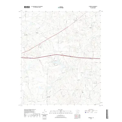
2019 Map of Starrville
USGS Topo · Published 2019About this map
Starrville and the surrounding Smith County countryside appear here as a landscape defined by small rural hubs and a network of family and community cemeteries. The terrain is intricately carved by numerous drainages, including Prairie Cr, Gooseneck Br, and Rice Cr, which feed into local catchments like Young Lake and Potter Lake. This 2019 survey documents the enduring settlement patterns of Northeast Texas, where historic locations such as Midway and Browning persist alongside modern transit corridors.
Find a feature on this map
70 named features on this map. Tap any name to fly to it.
Don’t see what you’re looking for? This feature index may not catch every label — zoom into the map to look around manually.
Map Details
Editions of this 2019 Starrville Map
This is the sole edition of this map. No revisions or reprints were ever made.
Other maps of this area

1936 · Kilgore
USGS Topo · 1:48,000

1938 · Winona
USGS Topo · 1:48,000

1940 · Kilgore
USGS Topo · 1:62,500

1943 · Winona
USGS Topo · 1:62,500

1956 · Tyler
USGS Topo · 1:250,000

1960 · Hawkins
USGS Topo · 1:24,000

1960 · Big Sandy
USGS Topo · 1:24,000

1960 · Gladewater
USGS Topo · 1:24,000

1966 · Hope Pond
USGS Topo · 1:24,000
1966 · Starrville
USGS Topo · 1:24,000