
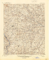
1893 Map of Statesville
USGS Topo · Published 1934About this map
The Catawba River and South Yadkin River define this Piedmont landscape, which in the late 19th century was a web of small agrarian settlements and water-powered industry. Statesville serves as the central hub, situated at the junction of the Western North Carolina Railroad and the Charlotte and Taylorsville Railroad. The map reveals a high density of rural gathering places, from the Eupeptic Springs resort area to numerous country meeting houses like St. Luke Ch. and Bethlehem Ch.
Find a feature on this map
165 named features on this map. Tap any name to fly to it.
Don’t see what you’re looking for? This feature index may not catch every label — zoom into the map to look around manually.
Map Details
Editions of this 1893 Statesville Map
2 editions found
Other maps of this area

1889 · Wilkesboro
USGS Topo · 1:125,000

1891 · Wilkesboro
USGS Topo · 1:125,000

1891 · Yadkinville
USGS Topo · 1:125,000

1893 · Yadkinville
USGS Topo · 1:125,000

1895 · Hickory
USGS Topo · 1:125,000

1914 · Gastonia
USGS Topo · 1:48,000

1916 · Gastonia
USGS Topo · 1:62,500

1941 · Charlotte
USGS Topo · 1:125,000

1942 · Charlotte
USGS Topo · 1:125,000

1949 · Kannapolis
USGS Topo · 1:24,000