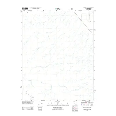
2012 Map of Station Peak
USGS Topo · Published 2012About this map
Station Peak and Red Mountain anchor this high-desert terrain on the California-Nevada border, where a complex network of ephemeral drainages defines the landscape. The hydrology of the region is traced by several significant seasonal flows, including Furnace Cr, Wildhorse Cr, and Indian Garden Cr, all radiating from the central peaks toward the surrounding basins. Evidence of the region's ranching and transit history is concentrated in the northeastern corner, where the infrastructure of the Dyer Airport meets local thoroughfares like Wright Rd and Windmill Rd. Near the southern edge of the survey, the Deep Springs Cow Camp suggests the enduring seasonal movement of livestock in this arid environment. This map captures a specific moment in the rural development of Esmeralda County, showing a sparse but vital grid of named roads like Easy St alongside the natural landmarks of the White Mountains range.
Find a feature on this map
15 named features on this map. Tap any name to fly to it.
Don’t see what you’re looking for? This feature index may not catch every label — zoom into the map to look around manually.
Map Details
Editions of this 2012 Station Peak Map
This is the sole edition of this map. No revisions or reprints were ever made.
Other maps of this area

1898 · Silver Peak
USGS Topo · 1:125,000

1900 · Silver Peak
USGS Topo · 1:125,000

1908 · Lida
USGS Topo · 1:250,000

1913 · Bishop
USGS Topo · 1:125,000

1913 · Lida
USGS Topo · 1:250,000

1917 · White Mountain
USGS Topo · 1:125,000

1947 · Mariposa
USGS Topo · 1:250,000

1948 · Mariposa
USGS Topo · 1:250,000

1951 · Blanco Mountain
USGS Topo · 1:62,500

1954 · Goldfield
USGS Topo · 1:250,000