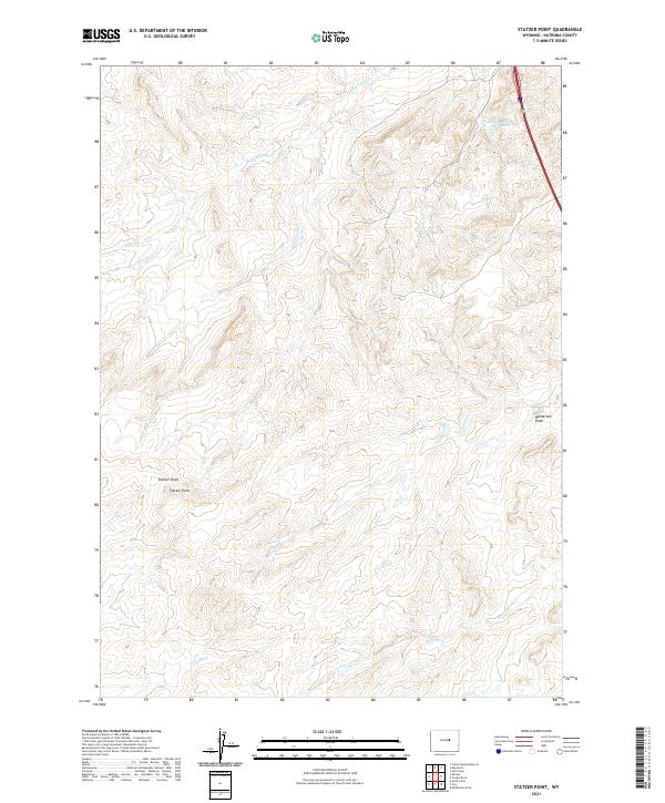
2021 Map of Statzer Point
USGS Topo · Published 2021About this map
Statzer Point rises as a primary landmark in this drainage-rich portion of Natrona County, where the high plains landscape is defined by an intricate network of intermittent watercourses and technical irrigation. The northern reaches are shaped by the S Fork Castle Cr, while the southeastern corner is drained by the aptly named Horse Ranch Cr. Of particular interest to local land-use historians is the Branton Ditch Reservoir near the northeastern boundary, which signifies the area's historical reliance on managed water systems for ranching operations. The topography is deeply incised by erosion patterns evident in Statzer Draw and Henderson Draw, illustrating the steady carving of the terrain by seasonal runoff. This survey provides a precise look at the township and range divisions, showing the intersection of t37n r80w and t38n r80w amidst a landscape of winding draws and creek beds.
Find a feature on this map
11 named features on this map. Tap any name to fly to it.
Don’t see what you’re looking for? This feature index may not catch every label — zoom into the map to look around manually.
Map Details
Editions of this 2021 Statzer Point Map
This is the sole edition of this map. No revisions or reprints were ever made.
Other maps of this area

1955 · Arminto
USGS Topo · 1:250,000

1958 · Arminto
USGS Topo · 1:250,000

1962 · Arminto
USGS Topo · 1:250,000

1968 · Big Gulch
USGS Topo · 1:24,000

1968 · Merino
USGS Topo · 1:24,000

1968 · Illco
USGS Topo · 1:24,000

1968 · Salt Creek
USGS Topo · 1:24,000
1968 · Statzer Point
USGS Topo · 1:24,000
1968 · Teapot Rock
USGS Topo · 1:24,000

1968 · Camel Hump Reservoir
USGS Topo · 1:24,000