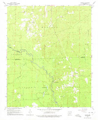
1964 Map of Staves
USGS Topo · Published 1975About this map
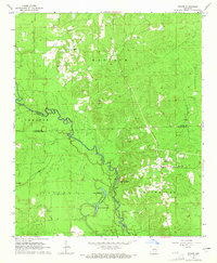
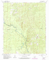
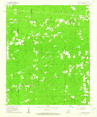
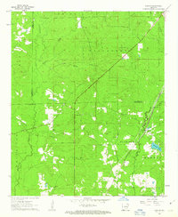
The Saline River winds through the borderlands of Grant, Dallas, and Cleveland Counties in this mid-1960s survey. The landscape is defined by the heavy meanders of the river and its tributaries, including Hurricane Creek and Canada Creek. Settlement is concentrated around the small community of Staves, which sits near a Lookout Tower and the Church of Christ. This rural area is dotted with family cemeteries and small country churches that reflect the genealogy of the region, such as Clement Cem, Canada Cem, and Bethany Ch. A notable feature of the river valley is the presence of Upper Canada Lake and Lower Canada Lake, likely oxbows formed by the shifting path of the Saline. The map also documents numerous Gravel Pits scattered throughout the hills, particularly in the northern reaches of Madison and Chester townships.
Find a feature on this map
33 named features on this map. Tap any name to fly to it.
Don’t see what you’re looking for? This feature index may not catch every label — zoom into the map to look around manually.
Map Details
Editions of this 1964 Staves Map
Other maps of this area

1953 · El Dorado
USGS Topo · 1:250,000

1955 · Little Rock
USGS Topo · 1:250,000

1956 · Little Rock
USGS Topo · 1:250,000

1957 · El Dorado
USGS Topo · 1:250,000

1958 · El Dorado
USGS Topo · 1:250,000

1960 · El Dorado
USGS Topo · 1:250,000

1960 · Little Rock
USGS Topo · 1:250,000
1962 · Pine Bluff NW
USGS Topo · 1:24,000
1962 · Kedron
USGS Topo · 1:24,000

1964 · Little Rock
USGS Topo · 1:250,000