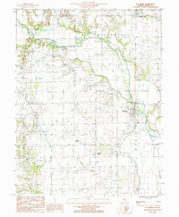
1985 Map of Ste Marie
USGS Topo · Published 1985About this map
Ste Marie serves as a focal point along the winding course of the Embarras River in Jasper County, where the landscape is defined by the river’s oxbows and a network of rural tributaries. The map reveals a community structured around early Illinois transport and religious life, anchored by St Marie Ch and several small cemeteries. North of the main settlement, the community of Willow Hill sits near Hickory Creek, while the stop at Boos marks a smaller node of activity in the agricultural grid. An Indian Mound near Pond Grove Creek provides a tangible link to much older human habitation in the valley. The presence of a Gaging Station and various levees highlights the ongoing management of the river's flood plain, while scattered features like a Gravel Pit and the Dead River show the natural and industrial shaping of the local terrain.
Find a feature on this map
17 named features on this map. Tap any name to fly to it.
Don’t see what you’re looking for? This feature index may not catch every label — zoom into the map to look around manually.
Map Details
Editions of this 1985 Ste Marie Map
This is the sole edition of this map. No revisions or reprints were ever made.
Other maps of this area

1910 · Hardinville
USGS Topo · 1:62,500

1940 · Greenup
USGS Topo · 1:62,500

1941 · Newton
USGS Topo · 1:62,500

1943 · Greenup
USGS Topo · 1:62,500

1943 · Newton
USGS Topo · 1:62,500

1953 · Indianapolis
USGS Topo · 1:250,000

1956 · Indianapolis
USGS Topo · 1:250,000

1956 · Annapolis
USGS Topo · 1:62,500

1956 · Vincennes
USGS Topo · 1:250,000

1957 · Indianapolis
USGS Topo · 1:250,000