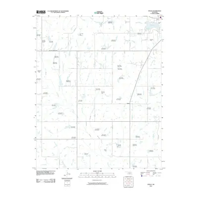
2010 Map of Stealy
USGS Topo · Published 2010About this map
Stealy and the surrounding McClain County countryside appear in this 2010 survey, defined by a complex network of water management and energy extraction. The landscape is dotted with numerous flood control structures, including Finn Creek Site 3a Dam and Oknoname 087036 Dam, which regulate the tributaries of Finn Creek and Turkey Creek. These engineering works coincide with a significant petroleum presence, as seen in the Northwest Flint Creek Oil Field and the Southwest Wayne Oil Field. To the northeast, the recreation and utility of Purcell Lake is anchored by Purcell Dam, with the nearby Hillside Cemetery serving as a local genealogical landmark. The map illustrates a transition toward modern rural infrastructure, where named section line roads like Sooner Ave and Ladd Ave facilitate access to both agricultural lands and active oil fields like Chandler Field.
Find a feature on this map
67 named features on this map. Tap any name to fly to it.
Don’t see what you’re looking for? This feature index may not catch every label — zoom into the map to look around manually.
Map Details
Editions of this 2010 Stealy Map
This is the sole edition of this map. No revisions or reprints were ever made.
Other maps of this area

1893 · Norman
USGS Topo · 1:62,500

1898 · Purcell
USGS Topo · 1:125,000

1898 · Pauls Valley
USGS Topo · 1:125,000

1902 · Pauls Valley
USGS Topo · 1:125,000

1902 · Rush Springs
USGS Topo · 1:125,000

1904 · Chickasha
USGS Topo · 1:125,000

1936 · Norman
USGS Topo · 1:62,500

1954 · Oklahoma City
USGS Topo · 1:250,000

1957 · Ardmore
USGS Topo · 1:250,000

1957 · Oklahoma City
USGS Topo · 1:250,000