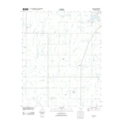
2013 Map of Stealy
USGS Topo · Published 2013About this map
The settlement of Stealy serves as a central point in this part of McClain County, which is defined by a dense network of petroleum exploration and agricultural drainage. Several active production areas are documented across the terrain, including the Northwest Flint Creek Oil Field, the West Flint Creek Oil Field, and the East French Oil Field. These industrial features sit alongside a landscape carved by waterways such as Turkey Creek, Finn Creek, and Second Cr. To the northeast, the outskirts of Purcell are marked by the presence of Purcell Lake and the Hillside Cem. The map illustrates a strictly organized grid of rural roads, including Ladd Ave, Sooner Ave, and Bryant Ave, which facilitate movement between the various oil fields and small homesteads scattered throughout the region.
Find a feature on this map
45 named features on this map. Tap any name to fly to it.
Don’t see what you’re looking for? This feature index may not catch every label — zoom into the map to look around manually.
Map Details
Editions of this 2013 Stealy Map
This is the sole edition of this map. No revisions or reprints were ever made.
Other maps of this area

1893 · Norman
USGS Topo · 1:62,500

1898 · Purcell
USGS Topo · 1:125,000

1898 · Pauls Valley
USGS Topo · 1:125,000

1902 · Pauls Valley
USGS Topo · 1:125,000

1902 · Rush Springs
USGS Topo · 1:125,000

1904 · Chickasha
USGS Topo · 1:125,000

1936 · Norman
USGS Topo · 1:62,500

1954 · Oklahoma City
USGS Topo · 1:250,000

1957 · Ardmore
USGS Topo · 1:250,000

1957 · Oklahoma City
USGS Topo · 1:250,000