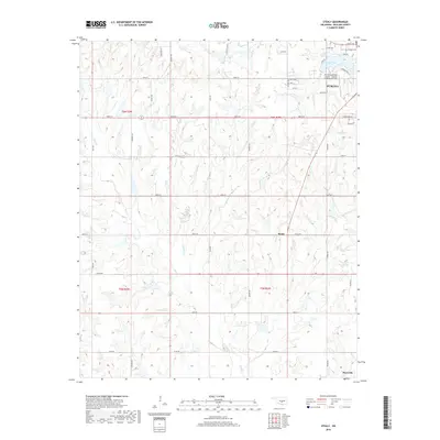
2018 Map of Stealy
USGS Topo · Published 2018About this map
Purcell anchors the northern reaches of this McClain County landscape, where the Purcell Municipal Airport - Steven E Shephard Field and Purcell Lake provide modern landmarks in a terrain defined by agricultural grid lines and rolling creek drainages. To the north, the Hillside Cem marks a local point of historical interest near Sunburst Ranch. The topography is etched by the meandering paths of Finn Creek, Turkey Creek, and Second Creek, which flow southward through the rural tracts. The small settlement of Stealy sits centrally along Stealy Road, while the map extends south toward the outskirts of Maysville. This survey illustrates the persistent section-line road network that dictates the movement and property divisions across this portion of central Oklahoma, connecting outlying rural residences to the regional hubs.
Find a feature on this map
46 named features on this map. Tap any name to fly to it.
Don’t see what you’re looking for? This feature index may not catch every label — zoom into the map to look around manually.
Map Details
Editions of this 2018 Stealy Map
This is the sole edition of this map. No revisions or reprints were ever made.
Other maps of this area

1893 · Norman
USGS Topo · 1:62,500

1898 · Purcell
USGS Topo · 1:125,000

1898 · Pauls Valley
USGS Topo · 1:125,000

1902 · Pauls Valley
USGS Topo · 1:125,000

1902 · Rush Springs
USGS Topo · 1:125,000

1904 · Chickasha
USGS Topo · 1:125,000

1936 · Norman
USGS Topo · 1:62,500

1954 · Oklahoma City
USGS Topo · 1:250,000

1957 · Ardmore
USGS Topo · 1:250,000

1957 · Oklahoma City
USGS Topo · 1:250,000