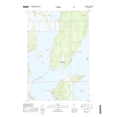
2019 Map of Steamboat Bay
USGS Topo · Published 2019About this map
Chippewa National Forest dominates this landscape in Cass County, where the dense timber meets the intricate shoreline of the Leech Lake system. The geography is defined by a series of prominent peninsulas and bays, including Oak Point, Pine Point, and the expansive Steamboat Bay. The transition from water to land is marked by complex wetlands and small islands like Minnesota Island and Goose Island, reflecting a wilderness character that remains preserved within the national forest boundaries.
Find a feature on this map
39 named features on this map. Tap any name to fly to it.
Don’t see what you’re looking for? This feature index may not catch every label — zoom into the map to look around manually.
Map Details
Editions of this 2019 Steamboat Bay Map
This is the sole edition of this map. No revisions or reprints were ever made.
Other maps of this area

1954 · Bemidji
USGS Topo · 1:250,000

1957 · Bemidji
USGS Topo · 1:250,000

1958 · Bemidji
USGS Topo · 1:250,000
1971 · Jack Lake
USGS Topo · 1:24,000

1971 · Sucker Lakes
USGS Topo · 1:24,000
1971 · Ottertail Point
USGS Topo · 1:24,000

1972 · Steamboat Bay
USGS Topo · 1:24,000

1972 · Benedict
USGS Topo · 1:24,000

1972 · Pike Bay
USGS Topo · 1:24,000
1972 · Akeley
USGS Topo · 1:24,000