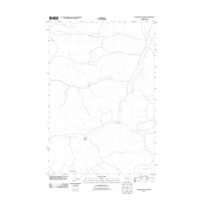
2011 Map of Steamboat Butte
USGS Topo · Published 2011About this map
Steamboat Butte rises above the drainage networks of Yellowstone County in this 2011 topographic study. The landscape is defined by the complex branching of Hawk Creek and its major tributary, Dry Fork Hawk Creek, which snake through the terrain. Human modification of the water system is evident at the Stephen Number 1 Dam in the central-western portion of the map.
Find a feature on this map
14 named features on this map. Tap any name to fly to it.
Don’t see what you’re looking for? This feature index may not catch every label — zoom into the map to look around manually.
Map Details
Editions of this 2011 Steamboat Butte Map
This is the sole edition of this map. No revisions or reprints were ever made.
Other maps of this area

1954 · Forsyth
USGS Topo · 1:250,000

1954 · Roundup
USGS Topo · 1:250,000

1957 · Forsyth
USGS Topo · 1:250,000

1958 · Roundup
USGS Topo · 1:250,000

1958 · Forsyth
USGS Topo · 1:250,000

1979 · Roundup
USGS Topo · 1:100,000

1979 · Corey Flat
USGS Topo · 1:24,000

1979 · Hysham
USGS Topo · 1:100,000

1979 · Chimney Butte
USGS Topo · 1:24,000
1980 · P K Ranch NE
USGS Topo · 1:24,000