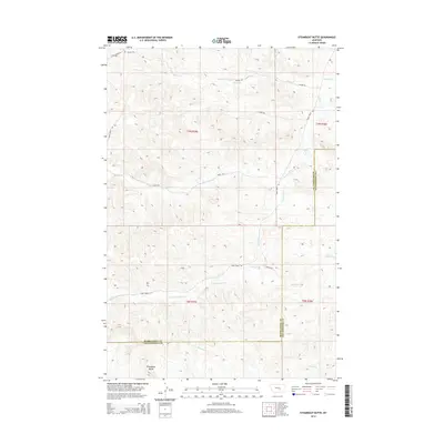
2014 Map of Steamboat Butte
USGS Topo · Published 2014About this map
Steamboat Butte rises as the dominant landmark in this Montana landscape, where the high plains of Musselshell and Yellowstone counties meet. The area is defined by a dendritic network of intermittent drainage, with Shovel Creek and Hawk Creek cutting deep into the terrain. A sparse network of ranch roads, including Hawk Creek Road, Jenson Road, and Fishel Creek Road, provides the primary access through these townships, tracing the natural contours of the land. This survey illustrates the vast, open character of the region, where water sources like Hibbard Creek and Dry Fork Hawk Creek have historically dictated the placement of homesteads and range boundaries. The presence of named tracks such as Fauth Road and Walker Road suggests the enduring presence of local ranching families in this part of the state.
Find a feature on this map
20 named features on this map. Tap any name to fly to it.
Don’t see what you’re looking for? This feature index may not catch every label — zoom into the map to look around manually.
Map Details
Editions of this 2014 Steamboat Butte Map
This is the sole edition of this map. No revisions or reprints were ever made.
Other maps of this area

1954 · Forsyth
USGS Topo · 1:250,000

1954 · Roundup
USGS Topo · 1:250,000

1957 · Forsyth
USGS Topo · 1:250,000

1958 · Roundup
USGS Topo · 1:250,000

1958 · Forsyth
USGS Topo · 1:250,000

1979 · Roundup
USGS Topo · 1:100,000

1979 · Corey Flat
USGS Topo · 1:24,000

1979 · Hysham
USGS Topo · 1:100,000

1979 · Chimney Butte
USGS Topo · 1:24,000
1980 · P K Ranch NE
USGS Topo · 1:24,000