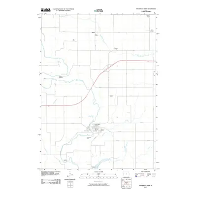
2010 Map of Steamboat Rock
USGS Topo · Published 2010About this map
The Iowa River carves a winding path through this central Iowa landscape, serving as the geographic anchor for the community of Steamboat Rock. To the south, the river feeds into Pine Lake, while to the north, the small settlements of Abbott and Cleves sit amidst a grid of rural roads and agricultural plots. The map reveals a high density of burial sites for a rural area, including German Township Cemetery, East Friesland Cemetery, Hazel Green Cemetery, and Clay Center Cemetery, providing significant leads for genealogists tracing family roots in Hardin County.
Find a feature on this map
44 named features on this map. Tap any name to fly to it.
Don’t see what you’re looking for? This feature index may not catch every label — zoom into the map to look around manually.
Map Details
Editions of this 2010 Steamboat Rock Map
This is the sole edition of this map. No revisions or reprints were ever made.
Other maps of this area

1954 · Waterloo
USGS Topo · 1:250,000

1955 · Waterloo
USGS Topo · 1:250,000

1979 · Ackley
USGS Topo · 1:24,000

1979 · Steamboat Rock
USGS Topo · 1:24,000

1979 · New Providence
USGS Topo · 1:24,000

1979 · Iowa Falls East
USGS Topo · 1:24,000

1979 · Eldora
USGS Topo · 1:24,000
1979 · Owasa
USGS Topo · 1:24,000

1980 · Aplington
USGS Topo · 1:24,000

1980 · Wellsburg
USGS Topo · 1:24,000