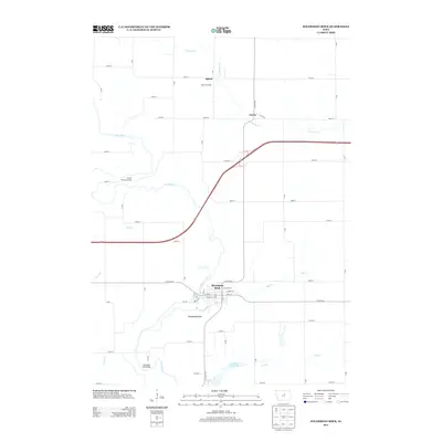
2013 Map of Steamboat Rock
USGS Topo · Published 2013About this map
The Iowa River carves a winding path through this Hardin County landscape, anchoring the namesake settlement of Steamboat Rock. The village layout is clearly defined by historical thoroughfares like Main St and River Rd, sitting just north of the scenic waters of Upper Pine Lake. Further north, the rural character of the region is punctuated by small clusters of development at Abbott, Abbott Crossing, and Cleves, which are connected by a precise grid of secondary roads and the prominent path of Co Hwy-S56.
Find a feature on this map
51 named features on this map. Tap any name to fly to it.
Don’t see what you’re looking for? This feature index may not catch every label — zoom into the map to look around manually.
Map Details
Editions of this 2013 Steamboat Rock Map
This is the sole edition of this map. No revisions or reprints were ever made.
Other maps of this area

1954 · Waterloo
USGS Topo · 1:250,000

1955 · Waterloo
USGS Topo · 1:250,000

1979 · Ackley
USGS Topo · 1:24,000

1979 · Steamboat Rock
USGS Topo · 1:24,000

1979 · New Providence
USGS Topo · 1:24,000

1979 · Iowa Falls East
USGS Topo · 1:24,000

1979 · Eldora
USGS Topo · 1:24,000
1979 · Owasa
USGS Topo · 1:24,000

1980 · Aplington
USGS Topo · 1:24,000

1980 · Wellsburg
USGS Topo · 1:24,000