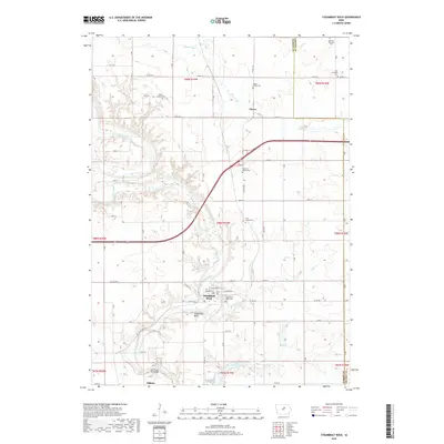
2018 Map of Steamboat Rock
USGS Topo · Published 2018About this map
The Iowa River carves a winding path through this central Iowa landscape, framing the namesake community of Steamboat Rock and the northern edge of Eldora. The terrain is defined by the sharp transition between the river's wooded bluffs and the surrounding agricultural uplands. Of particular interest to genealogists are the numerous scattered burial sites, ranging from established grounds like Steamboat Rock Cem and Hazel Green Cem to smaller, isolated markers such as the Leverton Family Plot and Egbers Family Plot.
Find a feature on this map
50 named features on this map. Tap any name to fly to it.
Don’t see what you’re looking for? This feature index may not catch every label — zoom into the map to look around manually.
Map Details
Editions of this 2018 Steamboat Rock Map
This is the sole edition of this map. No revisions or reprints were ever made.
Other maps of this area

1954 · Waterloo
USGS Topo · 1:250,000

1955 · Waterloo
USGS Topo · 1:250,000

1979 · Ackley
USGS Topo · 1:24,000

1979 · Steamboat Rock
USGS Topo · 1:24,000

1979 · New Providence
USGS Topo · 1:24,000

1979 · Iowa Falls East
USGS Topo · 1:24,000

1979 · Eldora
USGS Topo · 1:24,000
1979 · Owasa
USGS Topo · 1:24,000

1980 · Aplington
USGS Topo · 1:24,000

1980 · Wellsburg
USGS Topo · 1:24,000