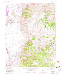
1967 Map of Steamboat
USGS Topo · Published 1983About this map
The city of Reno expands into the Truckee Meadows in this mid-century survey, with purple tinting indicating urban growth through 1979. The landscape is defined by the sharp transition from the valley floor to the high peaks of the Virginia Range, where mining activity is evidenced by labels like the Washington Mine and various quarries. Geothermal activity is a central feature of the local geology, notably at Steamboat Springs where numerous hot wells and geysers are documented near the southern edge of the meadow.
Find a feature on this map
1 named feature on this map. Tap any name to fly to it.
Don’t see what you’re looking for? This feature index may not catch every label — zoom into the map to look around manually.
Map Details
Editions of this 1967 Steamboat Map
4 editions found
Other maps of this area

1891 · Carson
USGS Topo · 1:125,000

1891 · Reno
USGS Topo · 1:125,000

1893 · Carson
USGS Topo · 1:125,000

1893 · Reno
USGS Topo · 1:125,000

1950 · Virginia City
USGS Topo · 1:62,500

1950 · Mt. Rose
USGS Topo · 1:62,500

1950 · Reno
USGS Topo · 1:62,500

1951 · Reno
USGS Topo · 1:62,500

1952 · Mt. Rose
USGS Topo · 1:62,500

1952 · Virginia City
USGS Topo · 1:62,500