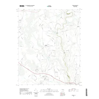
2019 Map of Stedman
USGS Topo · Published 2019About this map
The South River serves as the winding boundary between Cumberland and Sampson counties, anchoring a landscape defined by significant water systems and agricultural settlements. In the southern portion of the sheet, the town of Stedman is centered around the intersection of Clinton Rd and Front St, while to the east, Autryville marks the river crossing. The geography is characterized by distinct wetland features, including Brace Pogosin and Piney Pocosin, which influence the local drainage patterns. Historical family ties are evident through numerous small burial grounds and landmarks, such as Fisher Cem, McCall Cem, and Faircloths Bridge. The presence of Maxwell Millpond and Gaines Millpond on the tributaries of the S River point to a legacy of water-powered industry that once shaped these rural communities.
Find a feature on this map
113 named features on this map. Tap any name to fly to it.
Don’t see what you’re looking for? This feature index may not catch every label — zoom into the map to look around manually.
Map Details
Editions of this 2019 Stedman Map
This is the sole edition of this map. No revisions or reprints were ever made.
Other maps of this area

1948 · Fayetteville
USGS Topo · 1:62,500

1948 · Slocomb
USGS Topo · 1:24,000

1949 · Vander
USGS Topo · 1:24,000

1950 · Slocomb
USGS Topo · 1:24,000

1953 · Florence
USGS Topo · 1:250,000

1953 · Raleigh
USGS Topo · 1:250,000

1954 · Florence
USGS Topo · 1:250,000

1954 · Raleigh
USGS Topo · 1:250,000

1957 · Vander
USGS Topo · 1:24,000

1957 · Fayetteville
USGS Topo · 1:62,500