1961 Map of Steele Hollow
USGS Topo · Published 1962About this map
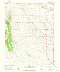
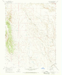
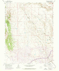
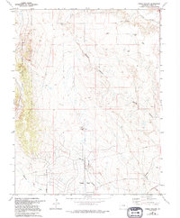
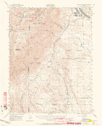
The Atchison Topeka And Santa Fe railroad cuts across the southeast corner of this landscape, marking a vital transit corridor through Colorado's arid terrain. Arroyos and intermittent watercourses define the topography, with drainage systems like Young Hollow and Steele Hollow carving paths toward the south and east. These natural features are interspersed with mid-century infrastructure, including a prominent Pipeline that traverses the central and southern sections, and a Radio Tower positioned on higher ground to the north.
Find a feature on this map
10 named features on this map. Tap any name to fly to it.
Don’t see what you’re looking for? This feature index may not catch every label — zoom into the map to look around manually.
Map Details
Editions of this 1961 Steele Hollow Map
4 editions found
Other maps of this area

1891 · Pueblo
USGS Topo · 1:125,000

1893 · Colorado Springs
USGS Topo · 1:125,000

1894 · Pueblo
USGS Topo · 1:125,000

1896 · Pueblo
USGS Topo · 1:125,000

1897 · Pueblo
USGS Topo · 1:125,000

1909 · Colorado Springs
USGS Topo · 1:125,000

1942 · Colorado Springs
USGS Topo · 1:125,000

1948 · Timber Mountain
USGS Topo · 1:24,000

1948 · Fountain SE
USGS Topo · 1:24,000
1948 · Mount Big Chief
USGS Topo · 1:62,500