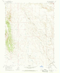
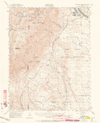
1961 Map of Steele Hollow
USGS Topo · Published 1968About this map
Atchison Topeka and Santa Fe rail lines cut through the southeastern corner of this high plains landscape, following the course of Potter Creek toward the Arkansas River valley. The terrain is defined by a series of drainage systems, most notably Steele Hollow, which runs centrally through the quadrangle. These seasonal waterways, including Wild Horse Creek and Dry Creek, indicate a ranching or grazing environment where water management was critical, evidenced by the presence of several Dam locations and scattered Well sites.
Find a feature on this map
13 named features on this map. Tap any name to fly to it.
Don’t see what you’re looking for? This feature index may not catch every label — zoom into the map to look around manually.
Map Details
Editions of this 1961 Steele Hollow Map
4 editions found
Other maps of this area

1891 · Pueblo
USGS Topo · 1:125,000

1893 · Colorado Springs
USGS Topo · 1:125,000

1894 · Pueblo
USGS Topo · 1:125,000

1896 · Pueblo
USGS Topo · 1:125,000

1897 · Pueblo
USGS Topo · 1:125,000

1909 · Colorado Springs
USGS Topo · 1:125,000

1942 · Colorado Springs
USGS Topo · 1:125,000

1948 · Timber Mountain
USGS Topo · 1:24,000

1948 · Fountain SE
USGS Topo · 1:24,000
1948 · Mount Big Chief
USGS Topo · 1:62,500