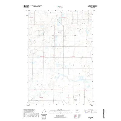
2020 Map of Steele NW
USGS Topo · Published 2020About this map
The prairie landscape of t140n r73w in Kidder County is defined by a dense concentration of wetlands and glacial potholes that dictate the local geography. This rural territory is organized by a strict sectional grid, where gravel and section roads like 29th St SE and 24th Ave SE navigate the undulating terrain of the Missouri Coteau. The land remains largely unpopulated, focused on agriculture and conservation, with the natural hydrography of small lakes and ponds filling nearly every low-lying depression in the landscape. One of the few significant cultural landmarks in this corner of the county is Woodlawn Cem, located in the southeastern portion of the map near 37th St SE. The survey illustrates a contemporary view of North Dakota's central plains, where the Public Land Survey System creates a geometric overlay across a complex natural drainage system.
Find a feature on this map
22 named features on this map. Tap any name to fly to it.
Don’t see what you’re looking for? This feature index may not catch every label — zoom into the map to look around manually.
Map Details
Editions of this 2020 Steele NW Map
This is the sole edition of this map. No revisions or reprints were ever made.
Other maps of this area

1951 · Driscoll
USGS Topo · 1:62,500

1952 · Dawson
USGS Topo · 1:24,000

1952 · Steele NE
USGS Topo · 1:24,000

1952 · Steele
USGS Topo · 1:24,000

1952 · Steele NW
USGS Topo · 1:24,000

1952 · New Rockford
USGS Topo · 1:250,000

1953 · Jamestown
USGS Topo · 1:250,000

1954 · Bismarck
USGS Topo · 1:250,000

1954 · McClusky
USGS Topo · 1:250,000

1956 · New Rockford
USGS Topo · 1:250,000