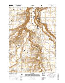
2014 Map of Steelhead Falls
USGS Topo · Published 2014About this map
Lake Billy Chinook and the deep gorges of the Deschutes River and Crooked River dominate this central Oregon landscape within the Crooked River National Grassland. The map reveals a dramatic convergence of water and high desert, where The Peninsula stands as a prominent landform between the carved channels of Carcass Canyon and Whychus Creek Canyon. For those tracing local history, the Geneva Cem sits near the Lower Desert on the western edge of the survey, while the southern reaches of the map highlight the drop at Steelhead Falls. The transition from the high plateaus of Green Mtn to the riparian corridors is marked by a network of rural roads such as SW Peninsula Dr and SW Sand Ridge Rd, illustrating the modern access into this deeply incised canyon country.
Find a feature on this map
63 named features on this map. Tap any name to fly to it.
Don’t see what you’re looking for? This feature index may not catch every label — zoom into the map to look around manually.
Map Details
Editions of this 2014 Steelhead Falls Map
This is the sole edition of this map. No revisions or reprints were ever made.
Other maps of this area

1926 · Bend
USGS Topo · 1:125,000

1928 · Madras
USGS Topo · 1:125,000

1929 · Bend
USGS Topo · 1:125,000

1931 · Madras
USGS Topo · 1:125,000

1955 · Bend
USGS Topo · 1:250,000

1957 · Bend
USGS Topo · 1:250,000

1958 · Bend
USGS Topo · 1:250,000

1961 · Redmond
USGS Topo · 1:24,000

1962 · Opal City
USGS Topo · 1:24,000

1962 · Fly Creek
USGS Topo · 1:24,000