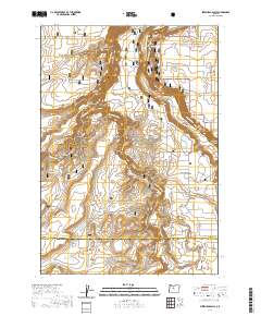
2020 Map of Steelhead Falls
USGS Topo · Published 2020About this map
Crooked River National Grassland dominates the central portion of this survey, where the deep incisions of the Deschutes River and the Crooked River converge. The landscape is defined by dramatic geological features such as the Peninsula, Otter Bench, and the sharp drop of Steelhead Falls. This area serves as a significant hydrological junction, marked by the presence of Opal Springs and the winding course of Whychus Cr through the Whychus Creek Canyon. While much of the terrain is characterized by the open expanse of the Lower Desert, the settlement of Crooked River Ranch sits on the eastern plateau above the Crooked River Gorge. Local historical markers are preserved in labels for the Grandview Cem and the former location of an Old Bridge near Alder Springs, providing specific points of interest for those tracing the development of this river-carved region.
Find a feature on this map
43 named features on this map. Tap any name to fly to it.
Don’t see what you’re looking for? This feature index may not catch every label — zoom into the map to look around manually.
Map Details
Editions of this 2020 Steelhead Falls Map
This is the sole edition of this map. No revisions or reprints were ever made.
Other maps of this area

1926 · Bend
USGS Topo · 1:125,000

1928 · Madras
USGS Topo · 1:125,000

1929 · Bend
USGS Topo · 1:125,000

1931 · Madras
USGS Topo · 1:125,000

1955 · Bend
USGS Topo · 1:250,000

1957 · Bend
USGS Topo · 1:250,000

1958 · Bend
USGS Topo · 1:250,000

1961 · Redmond
USGS Topo · 1:24,000

1962 · Opal City
USGS Topo · 1:24,000

1962 · Fly Creek
USGS Topo · 1:24,000