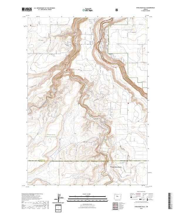
2023 Map of Steelhead Falls
USGS Topo · Published 2023About this map
The Deschutes Wild and Scenic River carves a deep path through the high desert of Central Oregon, meeting the Crooked River in a dramatic landscape of basalt canyons and plateaus. Much of the western terrain is preserved within the Crooked River National Grassland, where Whychus Creek Canyon and the Lower Desert define the open character of the land. In the southeast, the residential development of Crooked River Ranch sits atop the rimrocks overlooking the Crooked River Gorge. This map captures the intersection of rugged geological features like The Peninsula and Potter Canyon with modern recreational infrastructure, including the Opal Canyon Trl and Otter Bench Trl. At the southern edge, the namesake Steelhead Falls marks a significant drop in the river, while the historic Grandview Cem remains in the northwest corner near the Jefferson County line.
Find a feature on this map
42 named features on this map. Tap any name to fly to it.
Don’t see what you’re looking for? This feature index may not catch every label — zoom into the map to look around manually.
Map Details
Editions of this 2023 Steelhead Falls Map
This is the sole edition of this map. No revisions or reprints were ever made.
Other maps of this area

1926 · Bend
USGS Topo · 1:125,000

1928 · Madras
USGS Topo · 1:125,000

1929 · Bend
USGS Topo · 1:125,000

1931 · Madras
USGS Topo · 1:125,000

1955 · Bend
USGS Topo · 1:250,000

1957 · Bend
USGS Topo · 1:250,000

1958 · Bend
USGS Topo · 1:250,000

1961 · Redmond
USGS Topo · 1:24,000

1962 · Opal City
USGS Topo · 1:24,000

1962 · Fly Creek
USGS Topo · 1:24,000