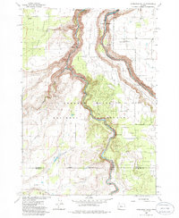
1985 Map of Steelhead Falls
USGS Topo · Published 1986About this map
Lake Billy Chinook and its confluence with the Deschutes River define this high-desert landscape in Central Oregon. The deep incisions of the Crooked River Gorge slice through the center of the map, separating The Peninsula from the vast expanse of the Crooked River National Grassland. The presence of several hydroelectric and water management features, such as the Powerplant, Opal Springs, Diversion Dam, and an Aqueduct, highlights the industrial utility of these canyon floors during the mid-1980s.
Find a feature on this map
30 named features on this map. Tap any name to fly to it.
Don’t see what you’re looking for? This feature index may not catch every label — zoom into the map to look around manually.
Map Details
Editions of this 1985 Steelhead Falls Map
This is the sole edition of this map. No revisions or reprints were ever made.
Other maps of this area

1926 · Bend
USGS Topo · 1:125,000

1928 · Madras
USGS Topo · 1:125,000

1929 · Bend
USGS Topo · 1:125,000

1931 · Madras
USGS Topo · 1:125,000

1955 · Bend
USGS Topo · 1:250,000

1957 · Bend
USGS Topo · 1:250,000

1958 · Bend
USGS Topo · 1:250,000

1961 · Redmond
USGS Topo · 1:24,000

1962 · Opal City
USGS Topo · 1:24,000

1962 · Fly Creek
USGS Topo · 1:24,000