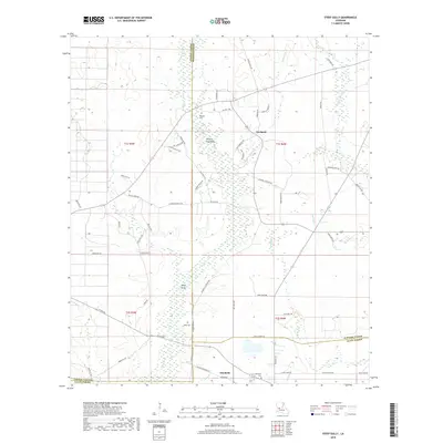
2018 Map of Steep Gully
USGS Topo · Published 2018About this map
The town of Elizabeth sits at the southern edge of this Louisiana landscape, where the borders of Vernon, Rapides, and Allen Parishes converge. The terrain is defined by a dense network of slow-moving waterways and drainage features like Hickory Log Gully, Steep Gully Br, and Cow Bayou, which cut through the timbered lowlands. This survey documents a rural infrastructure heavily tied to established family lines and local history, evidenced by the numerous named roads such as James Monk Rd, Bill Mack Rd, and Milburn Strother Rd. These roads connect small clusters of settlement at Westport and Steep Gully with vital community landmarks like Tenmile Cem and West Cem. The presence of Horseshoe and the residential area of Bufkin Hts near the southern boundary suggests a pocket of more concentrated development compared to the sprawling, water-braided landscape to the north.
Find a feature on this map
66 named features on this map. Tap any name to fly to it.
Don’t see what you’re looking for? This feature index may not catch every label — zoom into the map to look around manually.
Map Details
Editions of this 2018 Steep Gully Map
This is the sole edition of this map. No revisions or reprints were ever made.
Other maps of this area

1935 · Pawnee
USGS Topo · 1:31,680

1935 · Oakdale
USGS Topo · 1:31,680

1942 · Oakdale
USGS Topo · 1:62,500

1943 · Leander
USGS Topo · 1:62,500

1947 · Steep Gully
USGS Topo · 1:31,680

1947 · Elizabeth
USGS Topo · 1:31,680

1947 · Grant
USGS Topo · 1:31,680

1947 · Pitkin
USGS Topo · 1:31,680

1948 · Grant
USGS Topo · 1:24,000

1948 · Elizabeth
USGS Topo · 1:24,000